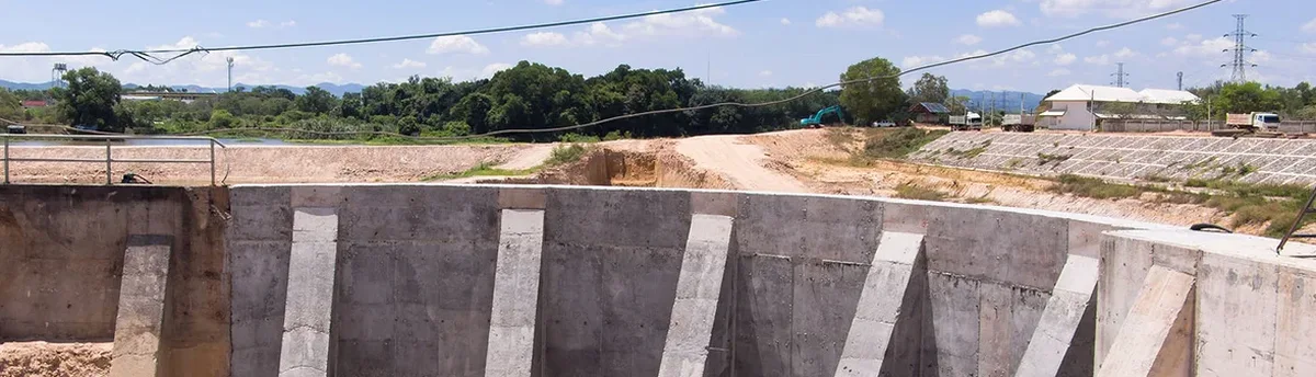
Guelph sits on a complex geological boundary where the Lockport dolostone meets thick layers of glacial till and outwash sand. This mix creates unpredictable excavation behavior, especially when you cut below the water table near the Speed River. In our experience monitoring projects from the Hanlon Creek business park to downtown intensification sites, the transition zone between weathered bedrock and overburden is where 90% of surprises happen. You can't rely on visual inspection alone. Our in-situ permeability tests help calibrate dewatering models before shoring goes in, and we often combine this with CPT soundings to map exactly where the till transitions to dense sand. The monitoring program we design for Guelph sites accounts for freeze-thaw cycling that loosens the upper two meters of overburden from November through April, something standard Ontario specifications don't always address explicitly.
In Guelph's dolostone-till transition zone, we've measured pore pressure spikes of 40 kPa within six hours of a rainfall event, enough to overload a soldier pile wall designed for dry conditions.
Scope of work in Guelph
Local geotechnical conditions in Guelph
A 12-story mixed-use project on Woolwich Street ran into trouble when the general contractor assumed the gray material at 5 meters was competent bedrock and stopped the shoring wall there. It was actually a weathered dolostone layer with vertical solution channels filled with soft clay, a remnant of ancient karst drainage. Rainfall pooled in those channels and triggered a rotational slip that displaced the north wall 38 millimeters in a single weekend. We caught it because the automated inclinometer array sent an alert at 2 a.m. Sunday morning. The engineer on call reviewed the data, confirmed the trend wasn't instrument drift, and ordered emergency dewatering and a row of tieback anchors by 8 a.m. Without continuous monitoring, that slip would have gone unnoticed until Monday, potentially compromising a neighboring 1890s limestone building. In Guelph, where heritage structures sit right at the property line downtown, the cost of monitoring is negligible compared to the cost of underpinning a century-old foundation that started moving.
Our services
Our Guelph monitoring programs align with the complete excavation design sequence, spanning initial investigation through construction and post-backfill settlement monitoring. The two principal service offerings we provide for local projects are:
Deep Excavation Monitoring for Urban Infill Projects
Full instrumentation package for shored cuts 6 to 20 meters deep in downtown Guelph. Includes automated inclinometer strings on soldier pile or secant walls, multilevel VW piezometers for staged dewatering verification, total station monitoring of adjacent buildings and utilities, and vibration monitoring when rock removal requires hydraulic hammering or controlled blasting. All data feeds into a secure web portal with customizable alert thresholds. We handle the initial baseline readings, the daily interpretation during active excavation, and the post-construction settlement monitoring period required by the city's building department.
Heritage Structure Protection Monitoring
Specialized vibration and settlement monitoring for excavation work within 15 meters of designated heritage properties, which are common throughout Guelph's downtown core and the St. Patrick's Ward area. We install triaxial velocity sensors on load-bearing walls and optical prisms at foundation corners, with a pre-construction condition survey that documents existing cracks and deformations to millimeter precision. The monitoring threshold for heritage masonry is set conservatively at 5 mm/s peak particle velocity, half the standard CSA limit, based on our experience with lime mortar structures dating from the 1870s to 1910s.
Frequently asked questions
What instrumentation do you recommend for a 4-meter-deep excavation in Guelph's glacial till?
For a 4-meter cut in till, we typically specify two inclinometer casings installed behind the shoring wall extending 3 meters below the excavation base, plus a standpipe piezometer to track groundwater levels during dewatering. If the excavation is within 10 meters of an existing building, we add at least four optical monitoring prisms on the adjacent foundation. The till in Guelph can be stiff in summer but loosens significantly during spring thaw, so we keep instruments running for at least two weeks after backfill to confirm stabilization.
How much does excavation monitoring cost for a typical Guelph residential or commercial project?
How does Guelph's bedrock affect monitoring requirements?
The Lockport dolostone underlying much of Guelph is fractured and contains solution channels that can transmit groundwater unpredictably. When excavation reaches the bedrock surface, we often see water inflow concentrated in vertical fissures rather than uniform seepage. This means piezometers need to be placed specifically where fractures are mapped during the pre-excavation investigation, otherwise they miss the hydraulic connection entirely. We also watch for differential settlement when footings bear partly on till and partly on dolostone.
What reporting do we receive during the monitoring period?
You receive a daily automated summary showing all instrument readings graphed against the baseline and alert thresholds. Once per week, a geotechnical engineer reviews the trends and provides a written interpretation covering any anomalies, the likely cause, and recommended actions if needed. If any instrument exceeds a preset threshold, the system sends an immediate SMS and email alert with the reading value, location, and the engineer on call's contact number.
Do you handle the permitting and coordination with the City of Guelph?
We prepare the monitoring plan as part of the shoring design submission package that goes to the city's building division. The plan specifies instrument types, locations, reading frequencies, and alert thresholds in the format Guelph's plan examiners expect. We also coordinate with Grand River Conservation Authority if the excavation is within a regulated area near the Speed or Eramosa rivers, where groundwater monitoring requirements are more stringent.