A mid-rise development near the Speed River encountered a surprise during excavation: a buried channel filled with soft organic silt that the initial borehole logs had missed. The developer needed a continuous subsurface image, fast. Seismic tomography provided the answer. By measuring compressional and shear wave velocities along a dense array of geophones, the survey mapped the lateral extent of the channel in a single afternoon. Guelph sits on a complex mix of glacial till, outwash deposits, and the underlying Guelph Formation dolostone. Point-specific tests like SPT drilling give you data at discrete locations. Tomography fills the gaps between boreholes. This matters when you are placing footings or designing retaining walls near buried valleys where conditions can change sharply over a few meters.
Seismic tomography maps what lies between the boreholes, turning a handful of point measurements into a continuous underground image.
Scope of work in Guelph
Local geotechnical conditions in Guelph
Guelph is underlain by the Silurian-age Guelph Formation, a dolostone unit prone to karst dissolution. Cavities, widened joints, and pinnacled rockheads create abrupt velocity contrasts that threaten foundation integrity. Boreholes can miss these features entirely. A 2018 geotechnical investigation near the University of Guelph campus encountered an unexpected 2-meter void at 14 meters depth that only appeared after cross-hole seismic tomography was performed. Refraction tomography flags these hazards because air- or water-filled voids produce a sharp velocity drop visible on the inverted section. The same survey also identifies zones of loose, uncompacted fill in former quarry areas scattered across the city's east side. Detecting these features early allows structural engineers to adjust foundation depth, specify controlled low-strength fill, or switch to a deep foundation system before the excavation phase.
Our services
Our Guelph seismic tomography program covers three survey configurations depending on target depth and resolution requirements.
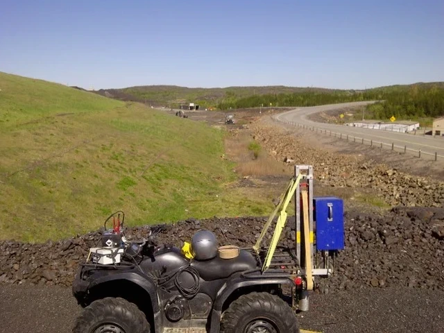
Seismic Refraction Tomography
Measures P-wave and S-wave velocities along a linear array. Ideal for mapping overburden thickness, bedrock topography, and rippability to depths of 30 meters. Each shot point is stacked 5 to 10 times to improve signal-to-noise ratio in noisy urban settings.
Seismic Reflection Profiling
Targets deeper bedrock stratigraphy and fault structures beyond 50 meters depth. Uses common-midpoint stacking to enhance reflected energy. Suitable for tunnel alignment studies and deep infrastructure planning in the Guelph area.
Cross-Hole Seismic Tomography
High-resolution velocity mapping between two or more boreholes. Detects karst cavities, fractured zones, and dissolution features within the Guelph Formation dolostone with sub-meter resolution.
Frequently asked questions
What does a seismic tomography survey cost for a typical Guelph site?
How long does a refraction tomography survey take on site?
A crew of two can complete one 69-meter refraction line in about two to three hours. Processing and interpretation require an additional two days to produce the final velocity cross-section and engineering log.
Can seismic tomography detect karst cavities in Guelph's dolostone?
Yes. Air- or water-filled cavities create a measurable velocity low on the tomographic image. Cross-hole tomography between boreholes provides the highest resolution for cavity detection, while surface refraction identifies larger dissolution zones and irregular rockhead.
What surface conditions limit seismic tomography performance?
Asphalt, concrete, and frozen ground couple well with geophones. Loose gravel, thick grass, and snow reduce coupling quality and can attenuate high-frequency signals. Urban noise from traffic and machinery also degrades data. We adjust source energy and stacking parameters to compensate for these conditions on Guelph sites.
What deliverables do I receive after the survey?
You receive a signed and stamped report containing the 2D P-wave velocity section, interpreted geologic cross-section, Vs30 profile per NBCC 2020, and a discussion of any anomalous zones identified. Raw SEG-2 field files are included upon request.