Too many excavation permits in Guelph get held up because the geotechnical report skips a proper slope analysis. The city sits right on the edge of the Niagara Escarpment, and the dolostone bedrock here isn't just a flat slab—it's fractured, jointed, and dips at angles that can surprise you. A standard borehole log won't catch a wedge failure waiting to happen. We run limit equilibrium models on every cut over 3 meters, factoring in the Eramosa River valley topography and the overconsolidated glacial till that blankets most of the region. Before you mobilize equipment, test pits help confirm the stratigraphy at the crest, and when groundwater is perched in the silty layers, in-situ permeability measurements feed directly into the pore pressure model.
A slope doesn't fail because the factor of safety is 0.99. It fails because nobody checked the groundwater conditions in April.
Scope of work in Guelph
Local geotechnical conditions in Guelph
Guelph's expansion east of Victoria Road and south toward the 401 corridor has pushed development onto terrain that was pasture for a century. Those gentle-looking drumlin slopes hide a legacy of shallow landsliding that predates European settlement. The Halton Till here is stiff but fissured, and when you expose it in a cut, relaxation cracks open within hours, letting water in. Add a wet spring—Guelph gets over 900 mm of precipitation annually—and the effective stress drops fast. We've mapped retrogressive failures in the Speed River valley that started as a small slump at the toe and stepped back 15 meters over a weekend. That's the scenario a desktop study misses. Our reports for City of Guelph permit applications include a geomorphological assessment of the site and its surroundings, not just a cross-section. The Grand River Conservation Authority also has jurisdiction in parts of the city, and they'll want to see a slope stability assessment if you're within the regulated area.
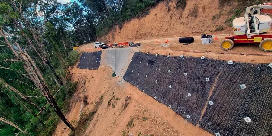
Our services
Each slope project in Guelph comes with a specific set of site conditions. We structure the scope around the failure mechanism that actually applies—not a generic checklist.
Natural and cut slope assessment
For subdivisions and commercial lots along the Eramosa and Speed River valleys. We model existing grade and proposed cuts, factoring in the weathered dolostone contact and the perched water table typical of Guelph's spring melt period.
Temporary excavation stability
Deep foundation excavations in the downtown core, where adjacent buildings and narrow right-of-ways demand a steep face. We analyze short-term stability with total stress parameters and specify stand-up time windows for the contractor.
Frequently asked questions
What triggers a slope stability review for a Guelph building permit?
The City of Guelph typically requires a slope stability assessment when the proposed cut or fill exceeds 1.2 meters in height and is within 30 meters of a property line or right-of-way, or when the site lies within the regulated area of the Grand River Conservation Authority. The report must be sealed by a professional engineer licensed in Ontario.
How much does a slope stability analysis cost in Guelph?
Do you use 2D or 3D slope models?
We primarily use 2D limit equilibrium software—Slide2 or SLOPE/W—which is the standard for Ontario building code compliance. For sites with complex geometry, like a corner lot where failure can wrap around in two directions, we can run a 3D analysis in RS3, but most Guelph conditions are adequately captured by a well-chosen cross-section.
What soil parameters do you need for the analysis?
At minimum, effective cohesion (c') and friction angle (φ') from consolidated-undrained triaxial tests with pore pressure measurement. For short-term excavations in clay, we also need undrained shear strength (Su). Unit weight and a groundwater monitoring record from a standpipe piezometer are essential—Guelph's perched water tables fluctuate seasonally and can't be guessed from a single reading.